
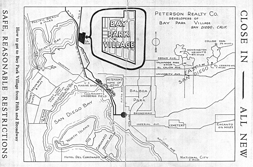
Bay Park Village 1936 Map
This vintage map offers a fascinating look at the early development of Bay Park Village, showing its location in relation to Mission Bay, Pacific Beach, downtown San Diego, and other surrounding communities. Created by Peterson Realty Co., developers of Bay Park Village, the map highlights just how new and relatively undeveloped the area was at the time. With the promise of being “close in — all new” and within easy reach of Mission Bay and the coast, it provides a glimpse into how Bay Park was originally marketed to San Diego homebuyers.